Starting from Barcelona, a four-day loop links the Costa Brava, the volcanic Garrotxa and the high passes of the Cerdanya, over roughly 520 km (about 320 miles). Here are the day-by-day stages, the pass altitudes, the best season to find them clear of snow, and practical notes on fuel and luggage.
What is the best route for a Catalan Pyrenees motorcycle road trip?
The simplest loop leaves Barcelona for the Costa Brava, climbs inland through Olot and the Camprodon valley, crosses the Collada de Toses into the Cerdanya, then returns over the Coll de la Creueta and through the Berguedà. Allow four days and about 520 km, with stages of 90 to 180 km.
The ride will start from Passeig de Gràcia, in the Eixample district, where a Good Motors point is opening soon. Distances in the table are estimates calculated on OpenStreetMap, so expect them to change with every detour and photo stop.
| Day | Stage | Distance | Pass and altitude | Highlights |
|---|---|---|---|---|
| 1 | Barcelona, Tossa de Mar, Sant Feliu de Guíxols | about 110 km | no pass, GI-682 coast road | Tossa old town, coves |
| 2 | Sant Feliu, Girona, Olot, Camprodon | about 140 km | Coll de Canes, about 1,120 m | Garrotxa volcanoes, Sant Joan de les Abadesses |
| 3 | Camprodon, Ripoll, Ribes de Freser, Puigcerdà | about 90 km | Collada de Toses, about 1,800 m | Freser valley, Cerdanya plain |
| 4 | Puigcerdà, La Molina, Castellar de n'Hug, Berga, Barcelona | about 180 km | Coll de la Creueta, about 1,900 m | Castellar de n'Hug, descent into the Berguedà |
How do you reach the Costa Brava on the GI-682?
On day one, head north out of Barcelona to Tossa de Mar, then follow the GI-682 to Sant Feliu de Guíxols. This stretch of about 22 km hugs the sea in tight bends above a string of coves. The full stage is short, around 110 km, which leaves plenty of time to stop in Tossa.
The coast road is narrow and many of its bends are blind. Leave yourself a margin, especially at weekends when traffic is heaviest. Sant Feliu de Guíxols makes a good overnight stop before you leave the coast behind.

Which passes do you cross between Olot and the Cerdanya?
On day two, ride to Olot via Girona, then cross the Coll de Canes, at about 1,120 m, towards Sant Joan de les Abadesses and Camprodon. On day three, climb through Ripoll and Ribes de Freser to the Collada de Toses, around 1,800 m on the N-260, before dropping down to Puigcerdà.
Olot is the gateway to the Garrotxa Volcanic Zone Natural Park, and its old cones are easy to pick out from the road. If you still have energy at the end of the day, a return trip from Camprodon takes you to the Coll d'Ares, at 1,513 m on the French border, about 18 km away.
The Toses climb runs for about 26 km from Ribes de Freser. The road is wide but the bends keep coming, and the Catalan press has described it as the most dangerous road in the province of Girona for motorcyclists. There is a hotel and restaurant at the top, handy for a break before the descent.
Which way back to Barcelona on the last day?
From Puigcerdà, climb towards La Molina and then the Coll de la Creueta, the high point of the loop at about 1,900 m. The BV-4031 then descends to Castellar de n'Hug and La Pobla de Lillet, before the road reaches Guardiola de Berguedà and Berga. From there, Barcelona is about 100 km away.
This is the longest day, at around 180 km. Set off early so you cross the pass with time in hand and reach the city before the evening traffic.

When should you go to find the passes clear?
Aim for the period from late spring to early autumn, when the risk of snow is lowest. In winter, the Collada de Toses and the Coll de la Creueta regularly require snow chains, and the BV-4031 has been closed outright during heavy snowfall. Check road conditions before every mountain stage, even outside the coldest months.
The Servei Català de Trànsit, the Catalan traffic authority, publishes road conditions, closures and chain requirements (in Catalan). Check it the evening before and the morning of each mountain day: on a motorcycle, a chain requirement means in practice that the pass is off for that day.
About 1,900 m: the altitude of the Coll de la Creueta, the high point of the loop, which local tourist boards put between 1,921 and 1,940 m. Source: Ripollès Turisme and Turisme del Berguedà
How should you plan fuel and luggage?
Fill up in the valley towns, Olot, Ripoll, Puigcerdà or Berga, rather than waiting for the mountains: between La Molina and the Berguedà, petrol stations are few and far between. For luggage, panniers, side cases and a top box are available to rent, enough to travel for four days without a rucksack.
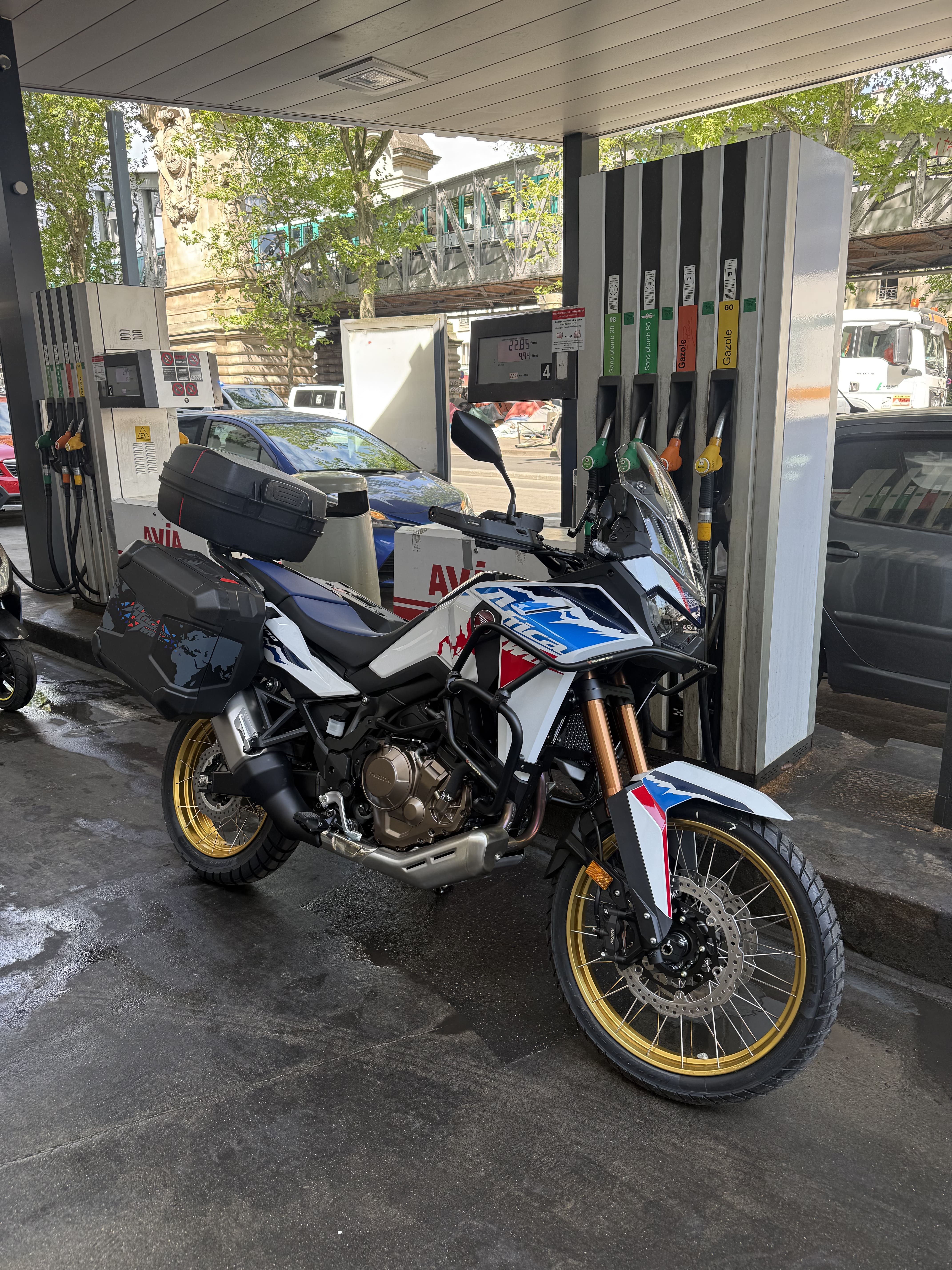
The official Spanish fuel station map lists stations and the fuels they sell. The motorcycle goes back with a full tank of 98-octane unleaded, along with a photo of the receipt and the fuel gauge. Straps and a phone holder come with every rental.
Which motorcycle suits this loop?
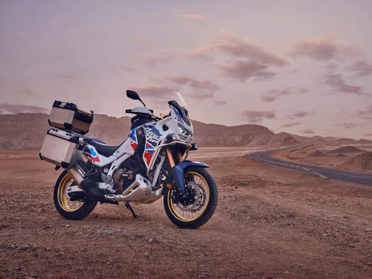
An adventure bike or a comfortable tourer suits this mix of coast road, mountain passes and fast main roads best. The Honda Africa Twin and the BMW R 12 G/S are large adventure bikes made for travelling loaded, while the Honda NT1100 puts wind protection first.
The Moto Guzzi V85 Travel offers a more relaxed position, welcome on long descents. On an A2 licence, the Honda NX500 keeps the adventure-bike posture with a 471 cc engine. The choice of models from Barcelona will be confirmed when the Passeig de Gràcia point opens.
Frequently asked questions
How many days do you need for a Catalan Pyrenees motorcycle road trip?
Four days let you ride the full loop without going over 180 km a day, with time to stop along the way. In three days, you can skip the Costa Brava stage and head straight for Olot. In two days, a return trip to the Collada de Toses via Ripoll is the most sensible option.
Can you cross a border during the trip?
Yes. The rental agreement allows riding within the European Economic Area and a few neighbouring countries, including Andorra, about 65 km from Puigcerdà via La Seu d'Urgell. From Camprodon, the Coll d'Ares leads straight into France. The rental itself always ends at a Good Motors point, agreed when you book.
Are the passes open all year round?
They stay open outside snow episodes, but winter often brings chain requirements on the Collada de Toses and the Coll de la Creueta, and the BV-4031 has been closed by snow before. From autumn onwards, check road conditions on the Servei Català de Trànsit website the evening before and the morning you set off.
Which licence do you need for this route?
A full A licence covers the Africa Twin, the R 12 G/S, the NT1100 and the V85 Travel. On an A2 licence, limited to 35 kW, the Honda NX500 lets you ride exactly the same loop, passes included: every road on the route is paved and none of it calls for a big engine.
To plan your trip, compare the adventure bikes and tourers in the motorcycle catalogue, then pick the one that matches your licence and your luggage.